Although the Osprey Tracking Project is over, historical maps and a lesson plan are still available.
About the Project
After migrating to Central and South America for the winter months, ospreys return to the same nest sites on creeks, rivers, and shorelines of the Chesapeake Bay every year. Once they arrive they may travel many miles a day in search of supplies for their nest and fish for their young.
CBF's Osprey Tracking project started in 2011 when conservation-minded Microwave Telemetry, Inc. (MTI) offered their services to support our education programs. The company manufactures devices researchers use to track avian and marine species. Using those tools it was possible to create a site where students and teachers could follow the daily feeding patterns and seasonal migrations of osprey over several years.
The criteria for choosing the birds were that they reside in an accessible nest and that the nest be close to student field programs operated daily by CBF. The location was critical so that students on field experiences could see the birds in the wild, discuss their habits, and then follow them online once back in the classroom. Teachers used the maps to integrate technology with biological concepts such as migration, habitat, and food sources and to infuse STEM (Science, Technology, Engineering, and Math) principles such as communication and collaboration into group activities. A lesson plan about ospreys provided teachers with further classroom material.
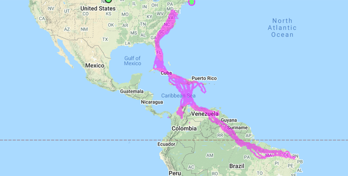
The Maps
Our ospreys have moved on, but this historical Osprey Tracking Map Data continues to serve as a tool students and teachers can use to better understand these beautiful creatures. Download our Great Osprey Migration lesson plan.
This image shows combined tracking data for several ospreys.
To access maps and tracking data for each bird, use the following links:
- Nick (Port Isobel/Tangier Island) View and download tracking data for Nick from Movebank.com
- Hackett (Meredith Creek) View and download tracking data for Hackett from Movebank.com
- Holly (Meredith Creek) View and download tracking data for Holly from Movebank.com
- Woody (Meredith Creek) Download tracking data for Woody from Movebank.com
- Quin (Kent Island) Download tracking data for Quin from Movebank.com
- Crabby (Port Isobel/Tangier Island) Download tracking data for Crabby from Movebank.com
On Movebank select the [i] icon to access the download (details) menu and download a spreadsheet of the GSM data.
As a rule of thumb, click the link to view the map to gain a general understanding of the bird's activities, and download the GSM data for specifics.
Special thanks to the team at Microwave Telemetry, Inc. and for the technical support provided by Rob Bierregaard PhD and Bryan Watts PhD, without whom this program would not be possible.