
Resources to Explore the Bay
There are dozens of ways to explore the Chesapeake Bay and its rivers. From mobile apps to websites to maps, here's our selection of resources to help you explore the Bay and its tributaries, paddle historic water trails, plan an excursion through history across the watershed, and even find healthy beaches.
Exploring the Bay and Its Tributaries

Chesapeake Explorer App
The National Park Service's Chesapeake Explorer mobile app helps users find and visit attractions across the Bay watershed, including parks, trails, camp grounds, museums, and historic sites. The ever-expanding app includes up-to-date visitor information, such as hours, locations, and fees. The app is available for iPhone and Android.
Online Chesapeake Bay, Susquehanna River & Tidal Tributaries Access Guide
The Chesapeake Bay Program's online Public Access Guide provides information on over 500 major public access sites in the Bay region. Users can find sites offering opportunities for boating, fishing, wildlife observation, and beach use. Search for public access point by address, city, or zip code. Or buy the brochure.
Water Trails
Captain John Smith Chesapeake National Historic Trail
Four hundred years ago Englishman John Smith set off with a small crew in an open boat to explore the Chesapeake Bay. Between 1607 and 1609 Smith mapped and documented nearly 3,000 miles of the Bay and its rivers. The trail, which follows his travels, was officially launched on May 12, 2007 and was the first national historic watertrail established by Congress. Visit the National Park Service's trail website for information, resources, and maps.
A Boater's Guide to the Captain John Smith Chesapeake National Historic Trail

Publication
This guide is a joint project of the National Park Service Chesapeake Bay Office, the Chesapeake Conservancy, and the Chesapeake Bay Foundation, and is written by retired CBF Senior Naturalist and Chesapeake boater extraordinaire, John Page Williams. It introduces paddlers and boaters to the best places to access the trail along with other practical information for boaters within the historical context of Captain John Smith's explorations 400 years ago. Download the guide (PDF, 102 pgs)

Web App
Released by The Chesapeake Conservancy on the 10 year anniversary of the Trail, the mobile app uses storymap technology from Esri to create an interactive series of maps that help users plan trips along the Trail from their computer, smartphone, or tablet. View the app.
Star-Spangled Banner National Historic Trail
America's second national historic watertrail, the Star-Spangled Banner trail tells the story of the Chesapeake Bay region's involvement in the War of 1812 and tells the stories of the events, people, and places that led to the birth of our National Anthem. Find out more at National Park Service's website.
Chesapeake Bay Interpretive Buoy System
This network of observation buoys mark points along the National Park Service's Captain John Smith Chesapeake National Historic Trail and Star Spangled Banner Historic Trail. Just pull out your cell phone and check real-time weather and environmental information like wind speed, temperature, and wave height at any buoy location. These "smart buoys" can also tell you something about John Smith's adventures during his 1608 voyage. Enjoy exploring the Bay with the help of the Chesapeake Bay Interpretive Buoy System (CBIBS), by phone at 877-BUOY-BAY (toll-free), or via smartphone apps for Android and iPhone.
More water trails and paddling opportunities throughout the Chesapeake Bay region—from New York to Virginia—can be found on the at Chesapeake Conservancy website.
Explore the Region
Find Your Chesapeake
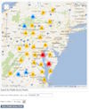
Your guide to exploring the Chesapeake Bay region. Learn about more than 360 parks, wildlife refuges, museums, sailing ships, historic communities, trails, and more. This is a great place to start planning your excursion.
Safe Swimming

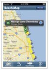
Maryland Healthy Beaches Google™ Earth Beach Notification System
Check the status of your favorite beach in Maryland.
Waterkeeper Swim Guide
Identify at a glance which beaches are clean for swimming and which have water quality problems, help protect your waterway by reporting pollution or environmental concerns, and more. View the swim guide website or get the app (available for Apple and Android).
Links to Bay-Related Websites
The following is a list of useful Chesapeake Bay and/or conservation related web sites. Your suggestions are welcome. Please e-mail us any additions or corrections.
- 10,000 Friends of Pennsylvania
- ActionBioscience
- Alliance for the Chesapeake Bay
- Anne Arundel Soil Conservation District
- Arundel Rivers Federation (merger of South River Federation and West/Rhode Riverkeeper)
- Assateague Island National Seashore
- BayDreaming.com
- Buy Fresh Buy Local Chesapeake
- Buy Fresh Buy Local Hampton Roads
- Chesapeake Explorer
- Chesapeake Research Consortium
- Chesapeake Stormwater Network
- Chesapeake Bay Trust
- Chesapeake Bay Program
- DC Environmental Education Consortium
- Discovery Village
- Donegal Chapter of Trout Unlimited
- EcoIQ.com
- Elizabeth River Project
- Enviro Link
- Environmental Building News
- EnvironmentalScience.org
- Environmental Defense Fund
- Friends of the Rappahannock
- Green Works for Pennsylvania
- How's My Waterway? The EPA has designed an interactive database of water quality monitoring reports for students to investigate elements like bacteria, dissolved oxygen, and others.
- James River Association
- Lackawanna River Corridor Association
- League of Conservation Voters
- Let's Be Water Smart Landscaping Guide (PDF)
- Lynnhaven River Now
- Marine Fish Conservation Network
- Maryland Department of the Environment
- Maryland Department of Natural Resources
- Maryland Department of Natural Resources: Eyes on the Bay
- Maryland Sea Grant
- Nanjemoy-Potomac Environmental Coalition
- NASA/Goddard Space Flight Center
- The Nature Conservancy (Virginia)
- Oyster Recovery Partnership
- Pennsylvania Citizens Advisory Council
- Pennsylvania Department of Environmental Protection
- Philadelphia Sailing Club
- Potomac Conservancy
- Restore America's Estuaries
- Southern Environmental Law Center (SELC)
- Smart Growth Maryland
- Spa Creek Conservancy
- Susquehanna River Trail Association
- Resources for Science Learning - Franklin Institute
- The Sierra Club
- The Ultimate Guide on Water Conservation: How to Save Every Drop
- USGS - Chesapeake Bay Region
- United States Fish and Wildlife Service
- University of Maryland Center for Environmental Science
- Virginia Department of Environmental Quality
- Virginia Department of Wildlife Resources
- Virginiaforever
- Virginia Institute of Marine Science
- Virginia Marine Resources Commission
- Wetlands Watch
- Woods Hole Oceanographic Institution